This guide sorts the main Georgia hiking trails by region (the country in the Caucasus, not the US state). For a first hiking trip, start in Kazbegi or Svaneti. Kazbegi has short, spectacular walks within a day of Tbilisi; Svaneti has the country's classic multi-day trek from Mestia to Ushguli. Tusheti is wilder and harder to reach, Borjomi-Kharagauli has long forest trails with shelters, and Lagodekhi has a waterfall walk and a tough trek to a border lake. High-mountain trails are open from about June to September, with July–September the reliable window.
Which of Georgia's hiking trails suits you
- With a couple of hours and no experience, try the Gveleti waterfall near Kazbegi or the information trail in Borjomi-Kharagauli, a 3 km loop of about 90 minutes[13][14].
- Half a day covers Gergeti Trinity Church, 3.5–4 hours in all with time at the top[9], or the Tsablnari trail in the forest above Batumi.
- A fit walker with a full day can choose Juta, the Lagodekhi waterfalls or the Footprint Trail in Borjomi-Kharagauli.
- For a first multi-day walk, take Mestia to Ushguli, with a guesthouse bed every night, or the Nikoloz Romanov trail, with shelters and moderate gradients.
- Experienced hikers can look at the Chaukhi Pass, the Atsunta pass, Black Rock Lake, or the St Andrew trail in Borjomi-Kharagauli, 54 km over up to 4 days and the most difficult route in the park[13][14].
- If you like using your hands, the Birtvisi canyon near Tbilisi is more scramble than walk.
Georgia hiking trails by region
Kazbegi: the easy start
Stepantsminda, 152 km (3–3.5 hours) from Tbilisi on the Military Highway, is the obvious first base. Walks to choose from:
- Gergeti Trinity Church (2,170 m): about 7 km return and 430 m of climbing, 60–75 minutes up for a fit walker, with Mt Kazbek (5,054 m) behind. The descent takes about 90 minutes and is harder on the knees[9]. See the Gergeti Trinity Church hike.
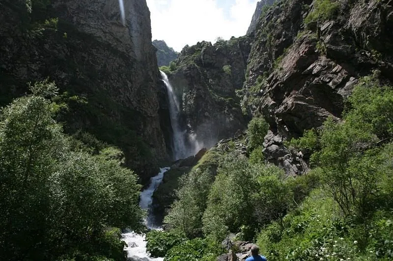
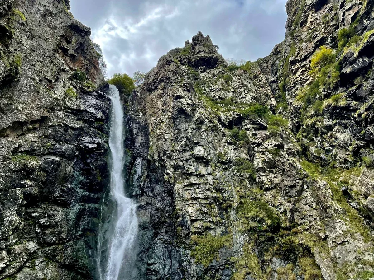
- Gveleti waterfall: a short walk of about an hour there and back from the Military Highway near the Dariali gorge, May–October; a good first outing on arrival day. It is about 4.2 km return with around 190 m of up and down[8], on a rocky path that can be wet near the water. When cloud hides Kazbek, this is the walk to fall back on.
- Truso valley: nearly flat, past travertines and a mineral lake, May–October; bring your passport for the border-police check. The full walk to Zakagori fortress and back is 21.9 km, about 6 hours[7]. If a 4x4 drives you part of the way, 3–4 hours on foot is enough to reach the travertines.
- Juta: about 10–12 km return with 360–400 m of climbing towards the Chaukhi spires, July–September. The one hard part is a short, steep climb from the village to the Fifth Season hut, a café and guesthouse on the meadow. The last 2.6 km of the road up from Sno has been closed to cars since a collapse in June 2025, so a village taxi takes you past the damage or you walk it, 40–90 minutes each way[6][10].
- The Chaukhi Pass (3,341 m): a hard 18–19 km crossing to Roshka and the Abudelauri lakes. It takes 8–10 hours and ends in another region, so a car has to drive round to meet you[22]. You can also reach the lakes from the Roshka side, a walk of roughly 2–3 hours up the valley. See Abudelauri lakes and the Chaukhi Pass.
The Gergeti glacier and Mt Kazbek itself need a mountain guide, ropes and glacier experience: they are mountaineering, not hiking. Our day hikes in Kazbegi National Park cover the shorter walks in more detail, and Truso or Juta compares the two valleys.
Svaneti: the classic trek
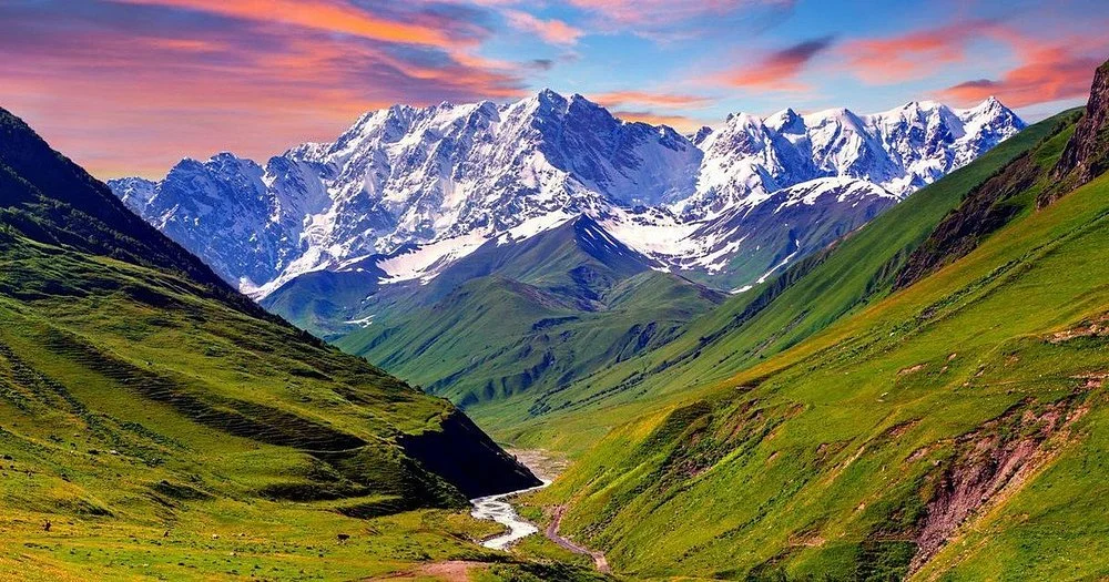
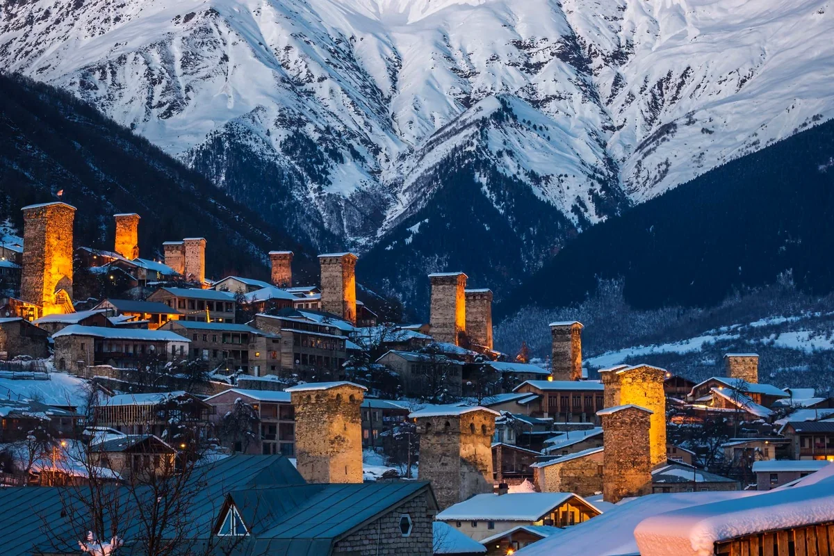
The Mestia–Ushguli trek is Georgia's classic multi-day walk: 57 km over four days, with about 3,100 m of climbing in total, sleeping in family guesthouses in Zhabeshi, Adishi, Iprali or Khalde and Ushguli. The high point is the Chkhutnieri pass at about 2,700 m, and the trickiest moment is fording the glacial Adishi river early in the morning, or crossing on a local's horse. The season is June to late October, busiest in August. Day hikes from Mestia include the Koruldi lakes (steep: about 1,460 m of climbing unless you take a 4x4 part of the way) and the Chalaadi glacier, where you should keep well back from the ice because of rockfall. Ushguli is one of Europe's highest villages. See our Mestia to Ushguli trek guide.
The two day hikes make a good warm-up. The lakes lie at 2,740 m, and a 4x4 to the Mestia Cross (about 2,200 m) leaves 3–4 hours of walking and about 550 m of climbing[11]. Chalaadi is the gentler outing: a forest path from a suspension bridge a short drive from town, about 2–3 hours return[12]. Carry your passport, as there may be a border-police check. Our Mestia guide has the rest of what to do in town.
Tusheti: remote and wild
Tusheti is reached by one 4x4 road over the Abano Pass (about 2,850 m), which usually opens in June (20 June in 2026) and closes between late September and late October. It has day walks between tower villages, such as Dartlo to Parsma, and serious multi-day treks, including Omalo to Shatili over the Atsunta pass (3,431 m), which runs near the Chechen border and needs your passport for border posts. There are no ATMs. It suits experienced hikers with time.
The region has more than a dozen marked trails, and the visitor centre in Omalo sells a map for a few lari[5]. Dartlo to Parsma takes a full day[2]. The Atsunta crossing takes about 5 days and is the only link to Khevsureti, because no road joins the two regions[2]. For the villages and the road, read our Tusheti guide; for the far end of the trek, the guide to Shatili and Mutso.
Borjomi-Kharagauli: forest trails
Georgia's big forest park has no admission fee, but you register at the visitor centre in Borjomi. Its longest route, the Nikoloz Romanov trail, is 43 km over three days from Likani to Marelisi, with two shelters, on foot or on horseback; several one-day trails start from Likani and Atskuri. The high trails are at their most pleasant from May to October.
The park marks 12 trails in all[13][14]. For one day, the Likani Valley trail is a 7 km circular walk of about half a day[13], and the Footprint Trail is 13 km and about 6 hours, climbing through forest to meadows[13][14]. The main visitor centre is at 23 Meskheti Street, usually open 10:00–18:00 on weekdays and 10:00–17:00 at weekends[15]. Staff give out trail maps and book the shelters, which are simple huts: bring your own food and a sleeping bag[14]. More in our guide to hiking in Borjomi-Kharagauli.
Lagodekhi: waterfall or border lake
In the far east of Kakheti, Lagodekhi has five marked trails. The popular day hike goes to the Grouse waterfall. The Black Rock Lake trek is a 38 km loop with nearly 2,900 m of climbing over 2–3 days, on the border with Dagestan, where border guards register passports; it is open about July–October.
The Black Grouse trail is about 9–9.5 km return and takes 3–5 hours through shady forest from the visitor centre[16][17]. A second waterfall walk, to Ninoskhevi, is rougher: about 8.5–10 km return and 4–6 hours, to a fall about 40 m high, crossing the stream several times without bridges[16][17]. Register at the visitor centre before any of them. There are two huts on the way to Black Rock Lake, so a tent is optional[3]. See our Lagodekhi National Park guide.
Near Tbilisi: the Birtvisi canyon
Birtvisi is the one real scramble within easy reach of the capital: a loop of about 8 km and 4–5 hours through rock towers to a medieval fortress, with short climbs where you use your hands[18]. It is poorly marked and slippery after rain, so go with someone who knows the way. March–June and September–November are the easiest months[18]. Read our Birtvisi canyon hike guide.
Near Batumi: Mtirala's forest
If you are on the Black Sea coast, the Tsablnari trail in Mtirala National Park is an easy walk of about 7 km in all from the visitor centre at Chakvistavi, with a 28 m waterfall after about 2 km[19]. It is walkable all year[19], though the path is wet and muddy for much of the year. See our guide to Mtirala and Kolkheti national parks.
When to hike
- May–June: lower trails (Borjomi, Lagodekhi waterfall, Truso). Snow lingers on high passes into late June.
- July–September: everything is open. August is busiest; September is often the clearest.
- October: good in the lower mountains and for autumn colour; high passes can get snow at any time.
- November–April: winter walks near Kazbegi and Borjomi only; the high trails are under snow. Borjomi-Kharagauli has two snowshoe trails, a 6 km day route from Atskuri and a 15.5 km circuit from Likani over 2 days[13][14]. The Jvari Pass on the road to Kazbegi can close for hours or 1–3 days after snow.
Getting to the trailheads and how long to allow
- Kazbegi: Juta and Truso both work as long day trips from Tbilisi, about 12 hours door to door, but a night in Stepantsminda makes either far more relaxed. Truso starts near Kobi, about 20 km south of town on the far side of the Jvari Pass[7]. Juta is about 30 minutes by 4x4 up a dirt road from Sno[24]. See how to get from Tbilisi to Kazbegi for the options.
- Svaneti: about 460 km and 8–10 hours by road, so allow at least three days even without a trek. Most trekkers take the train to Zugdidi and drive 3 hours to Mestia, then sleep there before setting off.
- Tusheti: about 190 km and 5–6 hours from Tbilisi, switching to a local 4x4 at Kvemo Alvani[5]. Don't drive the pass yourself. Plan at least three nights and keep a spare day before your flight, as rain or late snow can close the road.
- Borjomi: about 160 km and 2.5–3 hours by road, with the Likani entrance just west of town. The Kukushka train has not been running since 2020.
- Lagodekhi: about 160 km and 2.5–3 hours[23]. It works better as an extra day on a Kakheti wine trip than as a day trip from Tbilisi.
- Birtvisi: 1.25–1.5 hours on sealed roads; a normal car is fine.
Where to sleep and what it costs
In the high valleys you sleep in family guesthouses, usually with dinner and breakfast, in simple rooms that sometimes share a bathroom. On the Mestia–Ushguli route you don't need a tent or stove, but Adishi has only a handful of guesthouses, so book beds there in summer[1]. Juta has a few guesthouses and simple lodges, though most day visitors stay in Stepantsminda. Tusheti's guesthouses open in summer and have no heating, so nights can be cold even in August[5].
Local prices from recent reports, which change, so carry cash:
- A guesthouse in Tusheti costs around 80–120 GEL per person a night with breakfast[5].
- A shelter on the Black Rock Lake route is about 30 GEL per person. Walking the Lagodekhi trails is free; equipment hire and campsites have small charges.
- A horse across the Adishi river is about 20–25 GEL per person[1].
- A horse in Tusheti is about 40–50 GEL a day plus a horseman[2].
- A 4x4 up to Gergeti Trinity and back is roughly 15–25 GEL per person or 60–100 GEL per car[9][10]. A sealed road goes up in season, so many people drive up and walk down.
- A taxi from Stepantsminda to Truso and back is about 80–100 GEL[7].
- A taxi from Mestia to the Chalaadi bridge is about 50 GEL return with waiting.
What to pack
- Light hiking boots or trail shoes, plus sandals or water shoes for river crossings.
- A warm layer and a rain jacket, even in August. Stepantsminda, at about 1,740 m, sees August days of about 20 °C and nights of about 12 °C[20].
- Sun cream, sunglasses and a hat. The sun at altitude burns quickly.
- Water and food. There are few places to buy anything on the Kazbegi trails[21] and nothing on the Lagodekhi ones.
- Trekking poles, which help on long descents and in rivers, and a day pack of about 25–35 litres if your main bag goes ahead by car.
- A head torch and power bank, as power can be patchy in Tusheti.
Our Georgia packing list covers the rest of the trip, season by season.
Staying safe
- Insurance: travel insurance with at least 30,000 GEL of cover has been mandatory for visitors since 1 January 2026. Check that yours covers hiking and mountain rescue.
- Weather: summer afternoons often bring cloud and storms. Start early and turn back if the weather closes in on a pass.
- Border zones: Truso, Tusheti's Atsunta route and Lagodekhi's Black Rock Lake are near borders. Carry your passport, not a copy.
- Rivers: glacial rivers rise during the day. Ford early in the morning.
- Dogs: shepherds' dogs guard flocks on high pastures. Keep your distance, walk around the flock, and don't run.
- Plants: giant hogweed grows along some Kazbegi paths[21]. Its sap burns skin in sunlight, so don't touch it.
- Bears: they live in the Lagodekhi reserve but avoid people. Keep to the trail and don't leave food out.
- Cash: mountain villages often have no ATM; Mestia has the last one before Ushguli.
- Emergencies: 112 is Georgia's emergency number. Mobile coverage is patchy in the high valleys, so tell someone your route before you set off.
Guide or no guide?
A guide is not required on the main trails, and the Mestia–Ushguli route is well marked. A local guide still makes sense on high passes, in bad weather, on border-zone routes and for your first days in the mountains. They also sort out the practical side: guesthouses, horses across rivers and 4x4 transfers to trailheads.
Three routes are harder to follow alone. The path over the Chaukhi Pass is easy to lose on the scree in mist, the way among the rock towers at Birtvisi is poorly marked, and above Gergeti Trinity the ridge path towards the glacier is not well marked either. Black Rock Lake is also better with a local guide, as it is a big trek meant for fit, experienced hikers.
Georgia hiking tours with us
Our private Mestia to Ushguli trek has a mountain guide, guesthouses with half board and transfers from Tbilisi and back via Kutaisi. It lasts seven days, four of them on foot, with your main bag sent ahead by car. The private Juta valley hike is a long day from Tbilisi with a local hiking guide (July–September). The 2-day Kazbegi trip adds a night under Mt Kazbek and a Truso or Juta walk. The private Birtvisi canyon and fortress hike has a local guide, a picnic lunch and trekking poles, and suits fit walkers aged 12 and over. For Svaneti without the long trek, the private 5-day Svaneti tour has walks to the Chalaadi glacier and the Koruldi lakes. For Tusheti, see the Tusheti by 4x4, 4 days. With a week or more in summer, one Georgia hiking tour can take in both Kazbegi and Svaneti. See each tour page for the current price, or plan your own hiking trip and we send you a private route with a price. Nothing to pay now.
Sources
- Caucasus Trekking, "Trek from Mestia to Ushguli": caucasus-trekking.com
- Caucasus Trekking, Tusheti region: caucasus-trekking.com
- Caucasus Trekking, "Black Rock Lake": caucasus-trekking.com
- Agency of Protected Areas, Borjomi-Kharagauli National Park Administration: apa.gov.ge
- Wander-Lush, Tusheti guide: wander-lush.org
- Wander-Lush, "Complete Guide to the Juta Valley Hike": wander-lush.org
- Caucasus Trekking, "Hike in the Truso valley": caucasus-trekking.com
- Caucasus Trekking, "Walk to the Gveleti waterfalls": caucasus-trekking.com
- Wander-Lush, "Kazbegi to Gergeti Trinity Church hike guide" (updated March 2026): wander-lush.org
- Wander-Lush, "How to Travel From Tbilisi to Kazbegi in 2026": wander-lush.org
- Caucasus Trekking, "Hike to Koruldi lakes": caucasus-trekking.com
- Caucasus Trekking, "Chalaadi glacier": caucasus-trekking.com
- Georgia.to, "Borjomi-Kharagauli National Park Trails": georgia.to
- Borjomi-Kharagauli National Park: borjomi-kharagauli-np.ge
- Nationalparks.ge, "Borjomi-Kharagauli National Park": nationalparks.ge
- OrbiTrip, "Lagodekhi National Park day trip guide" (updated September 2026): orbitrip.ge
- Travel Surf Repeat, "Lagodekhi waterfalls: Ninoskhevi and Black Grouse": travelsurfrepeat.com
- AllTrails, "Birtvisi Fortress – Tetritskaro trail": alltrails.com
- Mtirala National Park, "Tsablnari Trail": nationalparks.ge
- Weather and Climate, "Kazbegi weather by month": weather-and-climate.com; Wikipedia, "Stepantsminda": en.wikipedia.org
- Caucasus Quest, "Top 5 Day Hikes in Kazbegi": caucasusquest.com
- Caucasus Trekking, "From Juta to Roshka via Chaukhi pass": caucasus-trekking.com
- Travel Tramp, "Lagodekhi National Park in Georgia": travel-tramp.com
- Bucketlistly, "Juta Valley complete hiking guide": bucketlistly.blog
Last checked: September 2026. Passes open and close with the snow each year, and trail conditions change after storms; check before you set out.