The short answer: the Abudelauri lakes are three small alpine lakes, known as the green, blue and white lakes, under the east face of the Chaukhi massif in Khevsureti. The easy way to see them is a walk of roughly 2–3 hours up the valley from the village of Roshka. The hard way is the classic crossing from Juta over the Chaukhi Pass (3,341 m), about 18–19 km and 8–10 hours, which ends in a different region from where you started. Both are July–September trips.
Where they are
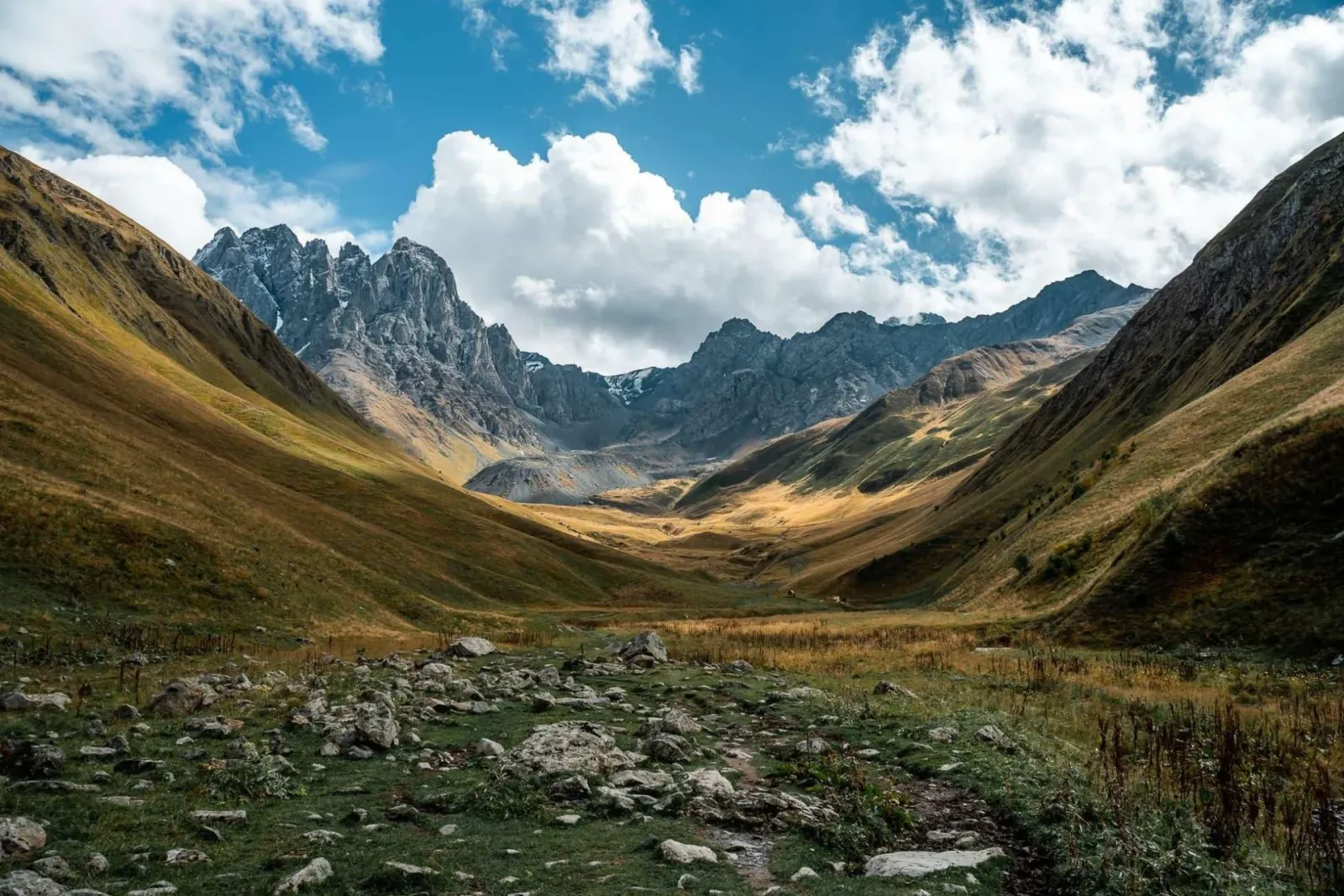
The Chaukhi massif is the wall of rocky spires you see from the Juta valley near Kazbegi, often called the "Georgian Dolomites". Juta is on its western side, in the Khevi region off the Georgian Military Highway. Roshka is on the eastern side, in Khevsureti, reached by the mountain road that leaves the Aragvi valley near Zhinvali and climbs past Barisakho towards Shatili. The two villages are close as the crow flies and a long drive apart by road, which is the whole logistical puzzle of this trek.
The highest spires reach 3,842 m. Juta itself was settled by Khevsurs from the far side of the ridge, and its families keep links with that region, so the trail over the pass is an old connection between the two valleys that trekkers now walk in summer.
The lakes
There are three lakes, each coloured differently by its water and bed: the green lake lower down in the meadows, a deeper blue lake, and the white lake right under the cliffs and the remains of the glacier, often with snow around it into July[1][2]. The meadows around them are scattered with large boulders, the "Roshka stones", and in summer shepherds graze sheep and cattle below. Camping spots and water sources are near the lakes[1].
Option 1: from Roshka to the lakes and back
From Roshka a path climbs up the valley to the lakes in roughly 2–3 hours, and you come back the same way. It is a steady uphill walk rather than a technical one, and it suits reasonably fit walkers who want the lakes without the pass. It works as part of a trip into Khevsureti: Roshka lies off the road to Shatili and Mutso, so you can walk to the lakes one day and continue to the tower villages the next. Our guide to Shatili and Mutso covers that road.
Option 2: the Juta–Roshka crossing over the Chaukhi Pass
The numbers
- Distance: about 18–19 km from Juta to Roshka[1][3].
- Climb: about 1,280–1,300 m of ascent, most of it on the Juta side[1].
- High point: the Chaukhi Pass at 3,341 m[1][3].
- Time: 8–10 hours for a fit walker in one long day[1][3]. Many people camp at the lakes and split it over two days.
- Difficulty: moderate from Juta, harder in the opposite direction, where the long climb comes from the Roshka side[1].
The route
From Juta (about 2,200 m) the trail heads up the valley past the Fifth Season hut and the meadows below the spires, the same route as the standard Juta day walk. Beyond the small lake under the peaks, the path turns steep: loose scree and, early in the season, old snow up to the pass. From the top you look straight down on the Abudelauri lakes. The descent is steep at first, reaching the lakes in about 2 hours[1], and then follows the valley down to Roshka.
Stage by stage from Juta
- Juta to the Fifth Season hut: about 30 minutes on a short, very steep path out of the village[3].
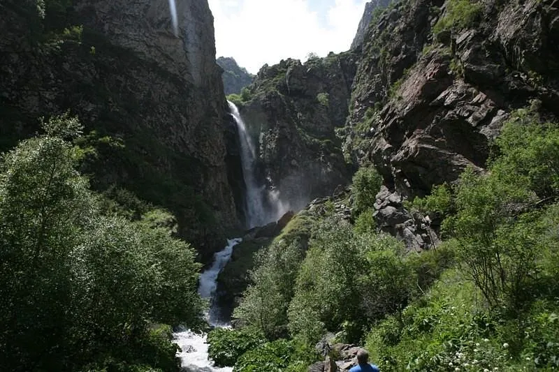
- The hut to the small lake and waterfall under the peaks: about 1.5 hours on a flat trail[3].
- The small lake to the Chaukhi Pass: about 2 more hours on the steep, loose section[3].
- The pass to the lakes: about 2 hours, steep at first[1].
- The lakes to Roshka: down the same valley path as Option 1. It takes 2–3 hours going up, so expect less on the way down.
One day or two
Camping at the lakes puts all the climbing on the first day and leaves an easier walk down to Roshka on the second, but you carry a tent and food over the pass. Sleeping at the Fifth Season the night before saves the steep climb out of Juta on the morning of the crossing.
Season
The pass usually becomes passable in the second half of June, and the reliable window is July to the end of September[1]. Before that, snow on the steep slopes below the pass is a real hazard, especially on the descent. From October, the first snow can come at any time.
Inside that window, July and August bring flowering meadows and the most reliable weather, and September is clearer and quieter. From October the Juta road and lodges wind down for winter.
Is it for you?
The crossing suits hikers with some mountain experience who are comfortable on scree and steep ground, can walk 8–10 hours, and carry proper boots, layers and waterproofs. The weather on the pass changes fast; clouds build on summer afternoons, so an early start matters. It is not for beginners, anyone uneasy on loose slopes, or a first day in the mountains. If that sounds like too much, the Juta valley walk to the Chaukhi view gives you the spires without the pass, and the Roshka walk gives you the lakes without it. Our comparison of Truso and Juta covers the easier walks near Kazbegi.
Getting to each end of the trek
To Juta
Juta is about 160 km and 3.5–4 hours from Tbilisi as far as the road closure, over the Jvari Pass (2,379 m) to Sno and then up the valley. The dirt road from Sno climbs for about 30 minutes by 4x4[3], and the seasonal shuttle that used to run up the valley has been discontinued[5]. Without your own driver, take a marshrutka (minibus) from Didube bus station in Tbilisi to Stepantsminda, about 3–3.5 hours and 20 GEL in 2026[5], and arrange a local 4x4 from there. Juta is about 20 km from town, 40–50 minutes to the closure. Our guide to getting from Tbilisi to Kazbegi compares the ways up.
To and from Roshka
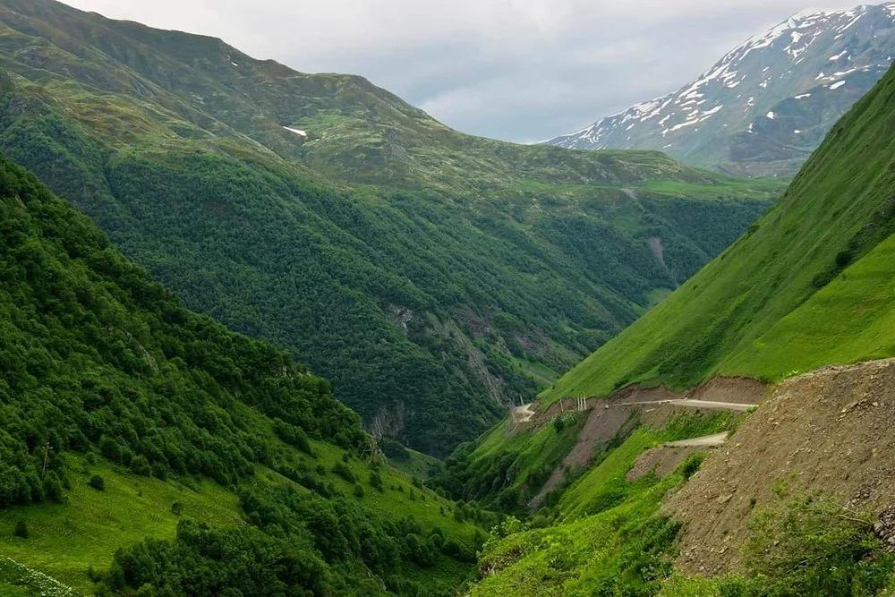
The road follows the Aragvi past the Zhinvali reservoir to Barisakho and Korsha, and is sealed for much of that stretch. Roshka is on the southern side of the Datvisjvari pass, so you don't cross the pass to reach it. Beyond Korsha, the road on to Shatili is a narrow unsealed track with steep drops and no barriers[6], at least 4–5 hours from Tbilisi in all. A marshrutka runs from Didube to Shatili twice a week, which is too rare to plan a pickup around.
Driving yourself
Most mainstream rental companies explicitly ban their cars from Juta and Khevsureti, and driving those roads in a standard rental, even a 4WD, can void your insurance[7]. Our guide to Georgia's 4x4 mountain roads explains the alternatives.
A three-day plan for the crossing
- Day 1: Tbilisi to Stepantsminda on the Military Highway, 152 km and 3–3.5 hours without stops. Our two-day Kazbegi plan covers the stops on the way and Gergeti Trinity Church in the evening light. Sleep in Stepantsminda or Juta.
- Day 2: an early start from Juta, over the pass to the lakes. Camp there, or carry on to Roshka if you are going in one long day.
- Day 3: down to Roshka and your waiting car, then back to Tbilisi or on towards Shatili and Mutso.
Add a spare day for the weather, and keep another before your flight home. If the forecast rules out the pass, swap the crossing for a walk in the Kazbegi National Park: the Truso valley is a nearly flat walk, far below the pass.
Where to sleep
- Stepantsminda: the main town and where most Juta visitors stay.
- Juta: a few family guesthouses in the village, and simple lodges and camping in the meadows above it, such as the Fifth Season.
- The lakes: camping spots with water sources nearby[1].
- Shatili, if you continue: family guesthouses, some inside restored towers, with simple rooms, sometimes shared bathrooms, and home-cooked dinners and breakfasts. Mutso is about 12 km further down the valley. See our Shatili page.
Logistics that catch people out
- The car has to go round. You start in Juta and finish in Roshka, and the drive between them runs back down the Military Highway and up into Khevsureti: most of a day for the driver. Arrange your pickup in Roshka before you set off; transport there is scarce, and hikers without a booking end up asking around the village for a driver[1].
- The Juta road. Since a collapse in June 2025, the last 2.6 km of the road from Sno to Juta has been closed to cars. Depending on the day, a village taxi runs past the damaged stretch or you walk it, which adds 40–90 minutes. We check the status before every Juta date.
- Weather decides. Keep a spare day. Crossing the pass in cloud or rain is unpleasant at the very least, and can be dangerous.
- Take a local guide. The path is used every summer, but in mist it is easy to lose on the scree. A hiking guide who knows the pass is worth it.
- Insurance. Travel insurance with at least 30,000 GEL of cover is mandatory for visitors since 1 January 2026; make sure yours covers mountain hiking.
What to carry
- Cash in lari and water: Juta has no ATM or shop of any size, and there are no ATMs in Khevsureti. Stock up in Stepantsminda.
- A warm layer and a rain jacket: the Juta valley runs from 2,200 to 2,600 m, and evenings in Khevsureti are cool even in August. Our Georgia packing list goes through the rest, including sunscreen, since sun at altitude burns quickly.
- A passport if you go on to Shatili: Juta needs no paperwork, but border police may check it on the road around Shatili and Mutso.
- A phone, without relying on it: mobile coverage is patchy in the high valleys and medical help is hours away. Georgia's emergency number is 112.
Shepherds' dogs guard the flocks on these pastures. Keep your distance, walk around the flock and don't run.
Walking Chaukhi and Abudelauri with us
We don't sell the pass crossing as a fixed tour, because the car has to go round and the day depends on the weather. What we offer instead: the private Juta valley hike, a long day from Tbilisi with a local hiking guide towards the Chaukhi view (July–September), and the Caucasus 4x4: Tusheti and Khevsureti in 8 days, which includes a Juta or Truso walking day and drives through Barisakho and Korsha on the way to Shatili. If you want the full Juta–Roshka crossing, tell us your dates: we can plan a trip with a mountain guide, a night in Kazbegi before and your own car waiting in Roshka. Nothing to pay now.
Sources
- Caucasus Trekking, "From Juta to Roshka via Chaukhi pass": caucasus-trekking.com
- Georgia Travel (Georgian National Tourism Administration), "Juta – Chaukhi – Abudelauri Lakes – Roshka": georgia.travel
- Bucketlistly, "Juta Valley complete hiking guide": bucketlistly.blog
- Travelsauro, "Hiking from Juta to Roshka via the Chaukhi Pass": travelsauro.com
- Wander-Lush, "Complete Guide to the Juta Valley Hike" and "How to Travel From Tbilisi to Kazbegi in 2026": wander-lush.org, wander-lush.org
- Wander-Lush, "How to get from Tbilisi to Shatili": wander-lush.org
- Wander-Lush, "Renting a Car in Tbilisi and Driving in Georgia in 2026": wander-lush.org
Last checked: September 2026. Snow on the pass and the state of the Juta road change every season; check conditions close to your date.